Selway River
Guage Readings
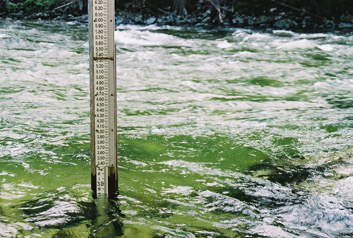
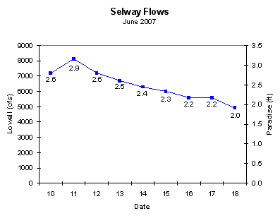
We had great water levels. Anything above 6 feet gets dangerous and anything below 2 feet gets really boney.
The guage check for the Selway is the guage near Lowell. Like other rivers, flow at this guage is measured by determining the height of a guage. This data, along with a profile of the river at the guage's location, is used to determine the flow rate in cubic-feet-per-second (cfs). But his guage station is well below the take-out, and is not reflective of the flow at Paradise - in general the flow at Paradise is one-fourth to one-fifth the flow at the take-out. This unfortunate situation, however, has been addressed by others.
I found a Microsoft Excel spreadsheet that contains data to convert the Lowell (in cfs) readings to Paradise readings (in ft). Although I do not know the source of the data, it is comparable to several other graphs I've seen comparing the flows at Lowell to those at Paradise. The following two graphs are from this Excel data:
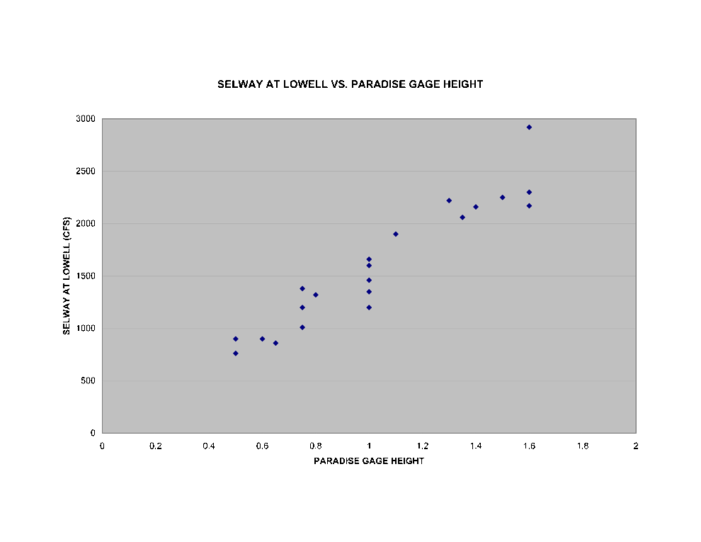
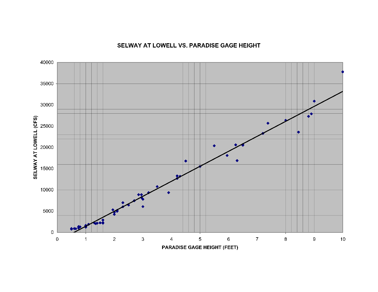
Once you are at the put-in, you can judge the river flow based on the following chart that plots the guage height at Paradise against the flow at Paradise (the data in this chart are from the hydrograph posted on the Forest Service's Four-Rivers Lottery web site):

The USGS reported the following flow data for our trip dates (June 12 to June 16):
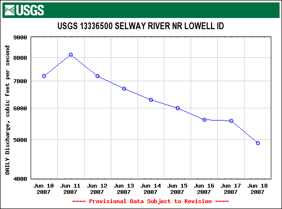
The Paradise guage heights at the top of this page were calculated using linear interpolations of the data from the Excel spreadsheet.


